
How to Access the West Orange Trail in Oakland, Winter Garden, Ocoee, and Apopka
The West Orange Trail spans 22 miles across some of Central Florida's most vibrant communities, but its real value for trail users and nearby homebuyers lies in its infrastructure. Four major stations and seven outposts strategically positioned along the route offer parking, amenities, and easy access points. Whether starting a morning ride from Killarney Station in Oakland or exploring the trail from Winter Garden, Ocoee, or Apopka, knowing where to access the trail makes the difference between a casual outing and a genuine lifestyle amenity.
Trailheads, Stations, and Outposts
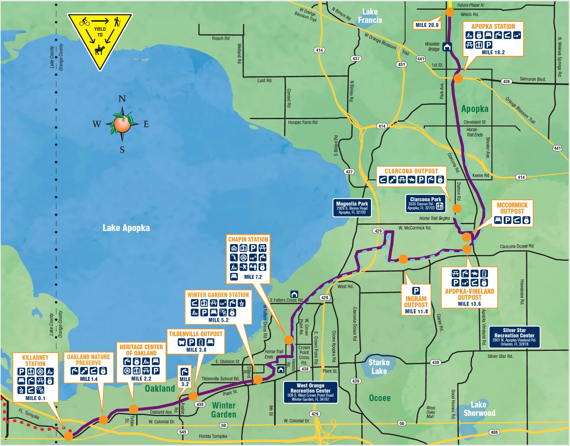
 The West Orange Trail is well-equipped from end to end. Four main stations anchor the route, each offering parking, restrooms, drinking fountains, bike racks, and picnic areas:
- Killarney Station | Mile 0.0 | Oakland/Lake County line | Bike rentals, playground, access to South Lake Trail westbound into Clermont, and beyond
- Winter Garden Station | Mile 5.2 | 455 East Plant Street, Winter Garden | Bike rentals, shops, and restaurants nearby
- Chapin Station | Mile 7.2 | 501 Crown Point Cross Road, Winter Garden | Basketball court, tennis courts, Path of Life memorial garden
- Apopka Station | Mile 18.2 | 111 South Forest Avenue, Apopka | Northern anchor with playground access
- Oakland Outpost
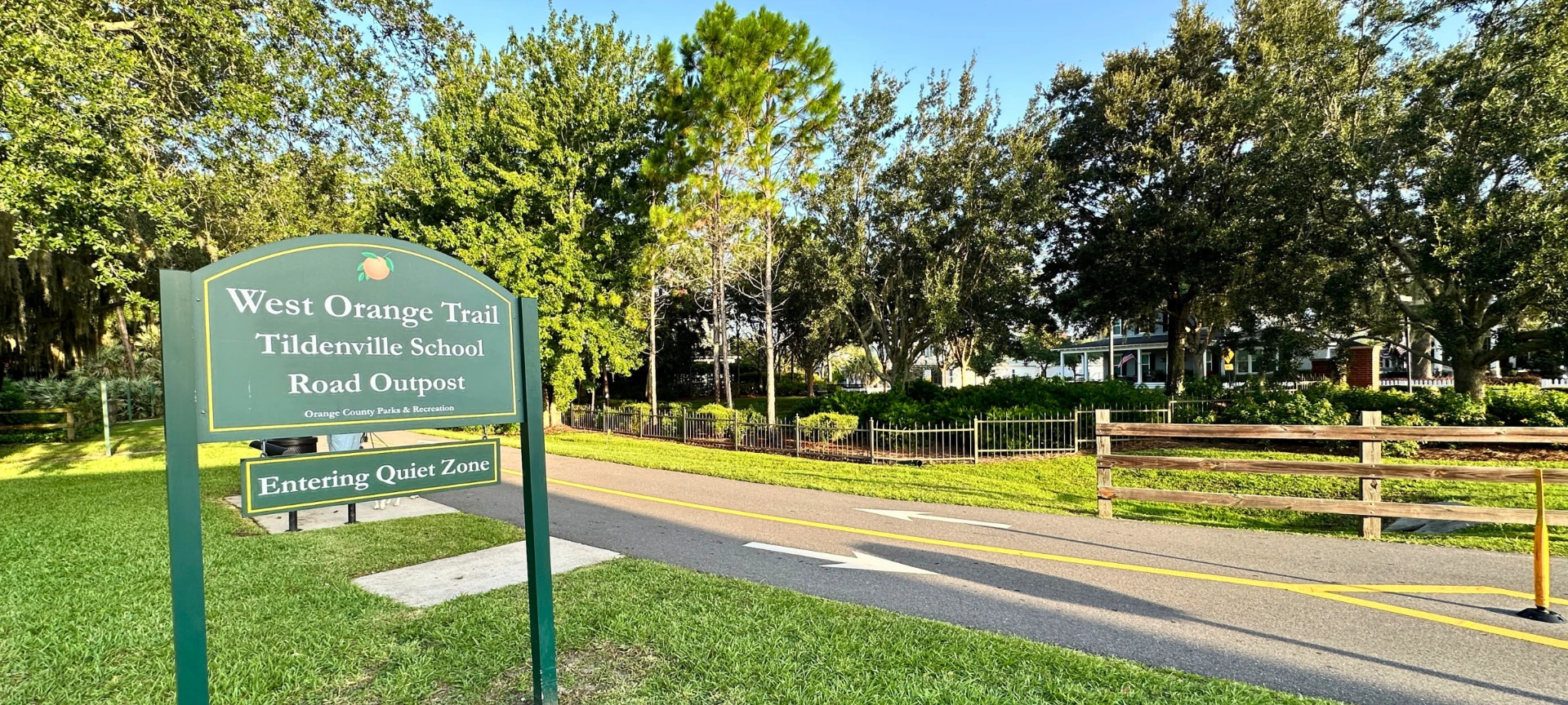
- Tildenville Outpost with Butterfly Garden
- Ingram Outpost
- Apopka-Vineland Outpost
- McCormick Outpost
- Clarcona Outpost
- Neighborhood Lakes West Trailhead
West Orange Trail Map & Guidelines
Getting to know the West Orange Trail starts with a map to get the lay of the land, including the trailhead locations, outposts, trail connectors, and amenities along the trail. Find everything from public restrooms, picnic areas, air stations, and parking. (Click to Enlarge)
The West Orange Trail and Florida's Coast-to-Coast Connector
The West Orange Trail is not just a local asset. It is a critical segment of the Florida Coast-to-Coast Connector Trail, known as the C2C, an ambitious statewide initiative to create a continuous, fully paved multi-use trail stretching 250 miles across Florida from St. Petersburg on the Gulf Coast to Titusville on the Atlantic Coast.
Currently 88 percent complete, the C2C is the first cross-state trail of its kind in Florida. When finished, it will link nine counties and dozens of communities, allowing cyclists and hikers to travel coast to coast entirely on dedicated trail infrastructure. The trail is funded in part through the Florida Department of Transportation's SUN Trail Program and is overseen by the Coast-to-Coast Trail Alliance under the Florida Department of Environmental Protection.
Florida's Coast-to-Coast Trail Map
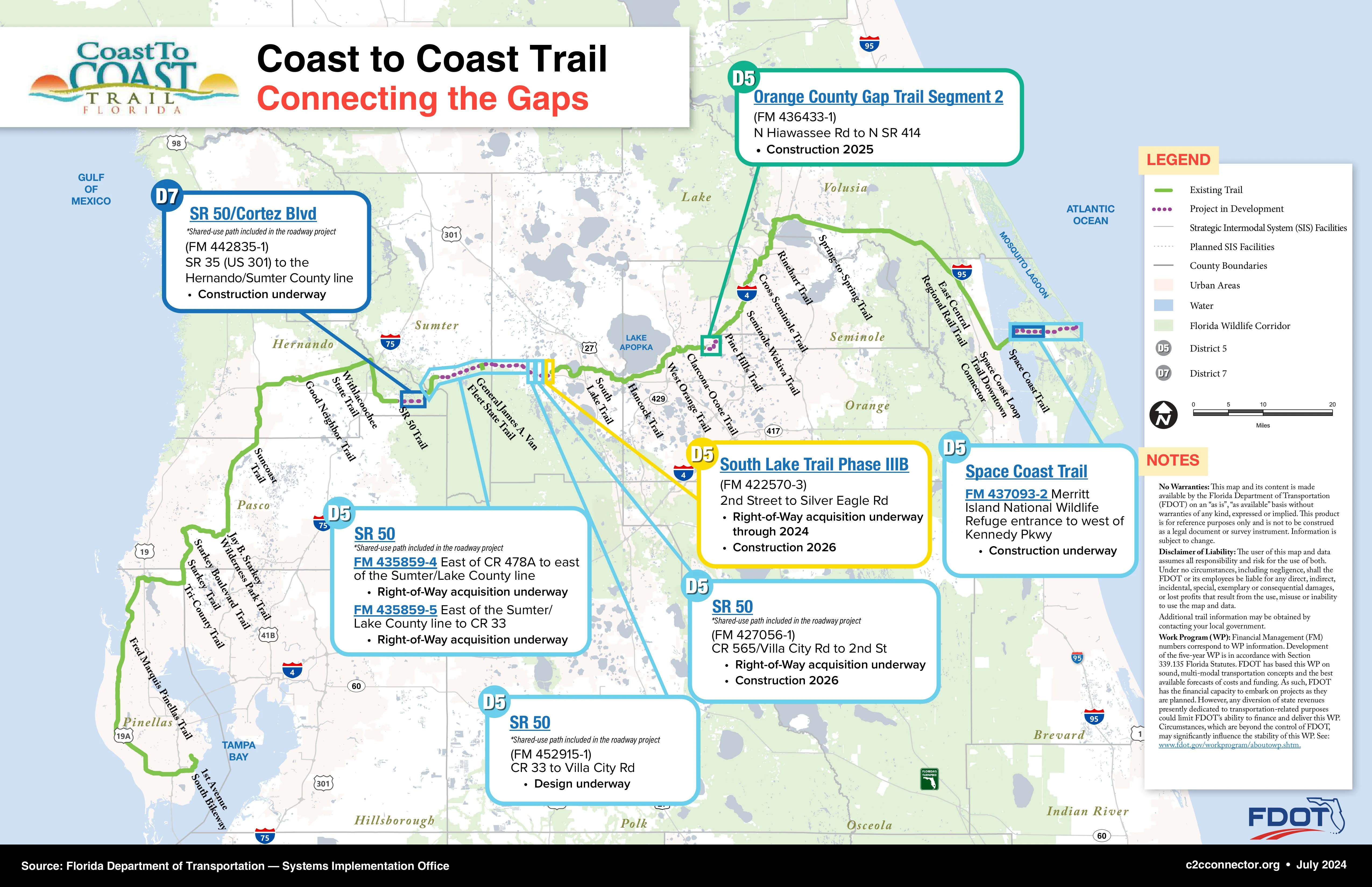
The West Orange Trail serves as the C2C's central Orange County segment. Here is how it connects to the broader system:
Heading West:
At Killarney Station, the trail transitions seamlessly into the South Lake Trail, which runs through Clermont and connects to the Lake Minneola Scenic Trail. That corridor continues westward through Lake County, eventually linking to the Withlacoochee State Trail, the Suncoast Trail, and the Pinellas Trail in Pinellas County, ending at St. Petersburg on Florida's Gulf Coast.
Heading East:
From the Apopka-Vineland Outpost, the C2C route connects via the Clarcona-Ocoee Connector Trail toward the Seminole-Wekiva Trail, then onward through the Cross Seminole Trail, the Rinehart Trail, the Spring-to-Spring Trail, and the East Central Regional Rail Trail to Titusville, ending at Canaveral National Seashore on the Atlantic.
The C2C also intersects with the 260-mile St. Johns River-to-Sea Loop and the 215-mile Heart of Florida Loop, making the West Orange Trail corridor a junction point in what will ultimately become one of the most extensive trail networks in the southeastern United States. A future extension of the West Orange Trail northward to Wekiwa Springs State Park is also planned, adding further connectivity to natural areas north of Apopka. For buyers considering the long view, this is infrastructure investment that has already appreciated the desirability of trail-adjacent real estate and will continue to do so as the network grows.
Real Estate Along the West Orange Trail
Homes with access to the West Orange Trail span a wide range of price points, community sizes, and architectural styles. What they share is a lifestyle orientation that buyers in this market actively seek out: the ability to walk, run, or bike out of your neighborhood and connect to miles of maintained trail, downtown amenities, and the broader natural landscape of West Orange County.
Below is a look at the key communities by area:
FAQs about the West Orange Trail
Where is the West Orange Trail?
The West Orange Trail is located in Orange County, Florida, west of Orlando extending through the cities of Oakland, Winter Garden, Ocoee, and Apopka.
How long is the West Orange Trail?
The West Orange Trail spans 22.32 miles, connecting Oakland, Winter Garden, Ocoee, and Apopka. It is also part of the larger Florida Coast-to-Coast Trail, a planned 253-mile route that will upon completion stretch from St. Petersburg on Florida’s west coast to Titusville’s Playalinda Beach, just north of Kennedy Space Center, on the east coast.
Where does the West Orange Trail start and end?
The West Orange Trail starts in Oakland, Florida at the Killarney Station, north of US-50 on Old Hwy 50E, just east of Clermont, Florida. The 22-mile trail ends in Apopka, FL at the intersection for E. Welch Road & Rock Springs Road.
What activities are permitted on the West Orange Trail?
The West Orange Trail is a multi-use trail that permits bicycles, mobility devices, pedestrians, skates, skateboards, horses, and some electric bikes (with restrictions).
Are there facilities along the West Orange Trail?
There are multiple stations and outposts along the trail, including Killarney Station, Winter Garden Station, Chapin Station, Clarcona Outpost, Apopka-Vineland Outpost, Tildenville Outpost, McCormick Outpost, Ingram Outpost, and Apopka Station. Amenities vary by location and may include picnic tables, parking, restrooms, and more.
When can the West Orange Trail be accessed?
The West Orange Trail is open from sunrise to sunset.
Are dogs permitted on the West Orange Trail?
Leashed pets are permitted on the West Orange Trail.
Are there communities or homes for sale along the West Orange Trail?
There are multiple neighborhoods and real estate options located along the West Orange Trail. Explore the trail communities and available homes offering buyers some of the closest access to the trail.